

Defining the Latitudinal Logistics of Chilean Travel
Planning an itinerary for Chile requires an understanding of its unique geography, stretching over 4,000 kilometers from north to south. Unlike compact destinations, Chile is divided into three distinct climatic and logistical zones: the arid Atacama Desert, the Mediterranean Central Valley, and the subantarctic Magallanes region.
Successful travel starts in Santiago, the nation’s primary international gateway via Arturo Merino Benítez International Airport (SCL). Travelers must account for significant internal transit times; a flight from the northern mining hubs to the southern fjords can exceed five hours, necessitating a "hub and spoke" itinerary design rather than a linear road trip.

Seasonal Synchronization and Regional Accessibility
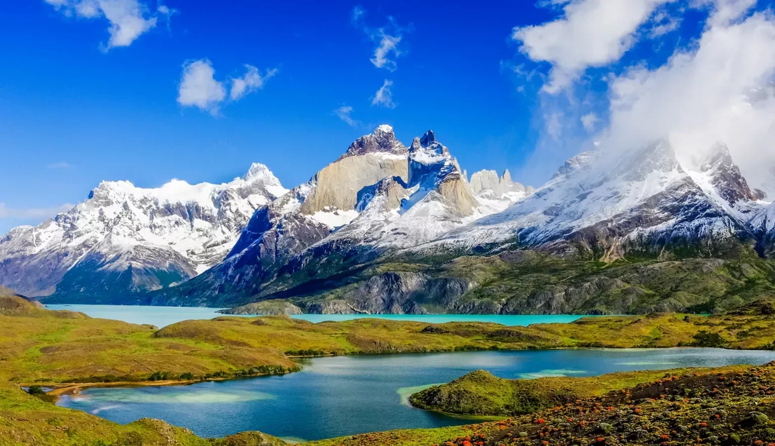
The Chilean seasons are inverted relative to the Northern Hemisphere, creating high-demand windows that vary by latitude. The southern trekking season in Torres del Paine National Park is strictly limited from November to March, coinciding with the austral summer. Outside of this window, many lodges in Patagonia cease operations due to extreme wind speeds and limited daylight.
Conversely, the Atacama Desert remains a year-round destination, though winter nights (June–August) frequently drop below freezing at high altitudes. For the Valparaíso and Casablanca wine regions, the harvest season in March and April offers the highest cultural value, providing a bridge between the extreme climates of the north and south.

The Infrastructure Gap: Digital Nomadism vs. Remote Trekking
While Chile boasts the highest internet penetration in South America, there is a stark digital divide between the Metropolitan Region and the southern wilderness. Travelers relying on the "digital nomad" lifestyle will find Santiago and Concepción equipped with world-class fiber optics, but connectivity vanishes entirely in the Aysén region and deep Patagonia.
This structural gap requires travelers to utilize offline mapping tools and satellite communication devices if venturing off the Carretera Austral. Furthermore, the country's banking system is highly digitized; however, "Cuenta RUT" limitations for foreigners mean that carrying a mix of CLP (Chilean Pesos) and high-limit credit cards is mandatory for rural transactions where Transbank terminals may fail.
| Feature | Northern Chile (Atacama) | Central Chile (Santiago/Valpo) | Southern Chile (Patagonia) |
|---|---|---|---|
| Primary Activity | Astro-tourism & Geology | Viticulture & Urban Culture | Glaciology & Trekking |
| Peak Months | Year-round (Best: Sept–Nov) | Oct–April | Nov–March |
| Logistical Hurdle | High-altitude acclimation | Urban congestion | Variable ferry schedules |
| Transport Hub | El Loa Airport (CJC) | SCL International | Punta Arenas (PUQ) |
Economic Exposure and the "Reciprocity" Regulatory Landscape
The financial cost of a Chile trip is heavily influenced by the volatility of the Chilean Peso (CLP) against the USD and Euro. As a member of the OECD, Chile maintains higher price points than its neighbors, Peru or Bolivia. Travelers must also monitor the evolving "Tourism Tax" and visa reciprocity fees; while many Western nations enter visa-free, regulatory shifts can occur based on bilateral diplomatic relations.
The high cost of entry is offset by the Sernatur (National Tourism Service) certifications. Looking for the "S" stamp (Sustentabilidad) or the "Q" stamp (Calidad) ensures that operators meet rigorous government standards, a crucial safety metric for high-risk activities like Andean mountaineering or Pacific surfing in Pichilemu.
Navigating the Multi-Modal Transit Requirement
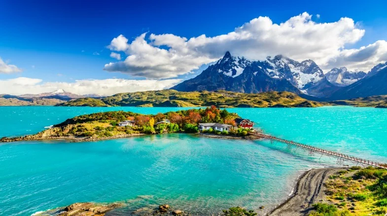
The final phase of planning must address the transition from air to land. In the north, 4x4 rentals are essential for navigating the Antofagasta region's salt flats. In the south, the complexity shifts to the Navimag ferry systems and the "Bimodal" route of the Carretera Austral, where vehicle space is limited and must be booked months in advance.
Travelers often underestimate the impact of the Humboldt Current, which keeps the coastal waters cold regardless of the season, impacting packing lists for the Lake District. The integration of private transfers, domestic flights via carriers like LATAM or Sky Airline, and regional maritime routes forms the backbone of a viable ultimate trip.
The increasing frequency of extreme weather events in the Andes creates a permanent state of uncertainty for high-altitude passes, particularly the Los Libertadores crossing to Argentina, which can close without warning due to snow even in late spring.
Comments (0)
Please login to comment
Sign in to share your thoughts and connect with the community
Loading...