
Evolution of the World’s Longest Karst System
Mammoth Cave National Park, located in central Kentucky, remains the undisputed leader in global speleology with over 426 miles of surveyed passages. This vast network is a product of Mississippian-aged limestone capped by a protective layer of sandstone and shale, which has prevented the ceiling from collapsing while allowing water to carve intricate lower levels.
The system is not a single cavern but a complex "stack" of five distinct levels formed over millions of years as the Green River deepened its valley. This geological layering allows for diverse formations, ranging from the massive, dry "avenues" to the delicate, water-carved "canyons" found in the deeper, active regions of the cave.
 Credit: Courtesy of Mammoth Cave National Park
The Frozen Niagara and Hydrogeological Wonders
One of the most significant landmarks within the park is the Frozen Niagara section, a massive "flowstone" formation that resembles a waterfall turned to stone. Unlike the vast, dry upper levels, this area demonstrates active speleothem growth, where mineral-rich water creates stalactites, stalagmites, and intricate draperies.
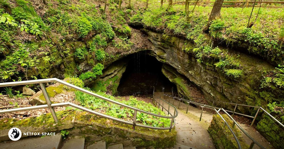
karst topography and cave formation process, do AI tạo
Shutterstock
The presence of the Echo River at the cave's lowest explored depths highlights the ongoing hydrological process. This underground river system serves as a critical drainage point for the surrounding Pennyroyal Plateau, illustrating the direct connection between surface land use and subterranean water quality.
Structural Complexity: What Lies Beyond the Mapped 426 Miles
While 426 miles are officially documented, speleologists from the Cave Research Foundation (CRF) suggest the system could potentially span over 600 or even 1,000 miles. The primary challenge in mapping is not just physical endurance but the "bottleneck" effect of structural collapses and silt-filled passages that separate known segments from undiscovered voids.
| Exploration Milestone | Year | Significance |
|---|---|---|
| First Survey Recorded | 1810s | Initial mapping for saltpeter mining during the War of 1812. |
| Flint Ridge Connection | 1972 | Proven link between Flint Ridge and Mammoth Cave, doubling the known length. |
| Roppel Cave Connection | 1983 | Integrated another major system, cementing its world-record status. |
| 400-Mile Benchmark | 2014 | Official certification of the 400th mile of surveyed passage. |
| Current Mapped Length | 2026 | 426+ miles and growing through annual CRF expeditions. |
Unlike competitors like Sistema Sac Actun in Mexico, which is largely underwater, Mammoth Cave’s complexity lies in its multi-level verticality. Recent explorations utilize LiDAR technology to identify surface depressions (sinkholes) that may lead to previously inaccessible upper-level chambers, bypassing traditional "squeeze" entrances.
 Credit: Courtesy of Mammoth Cave National Park
Ecosystem Vulnerability and the Biodiversity Frontier
Mammoth Cave is a UNESCO World Heritage site and an International Biosphere Reserve, hosting over 130 species that rely exclusively on this dark environment. The Kentucky Cave Shrimp (Palaemonias ganteri) and various species of blind cavefish represent extreme evolutionary adaptation, existing in an environment with zero primary production from sunlight.
The survival of these species is increasingly tied to the Integrated Pest Management protocols and white-nose syndrome mitigation strategies managed by the National Park Service. Chemical runoff from regional agriculture and changes in the Green River’s flow due to dam management pose structural risks to the delicate chemical balance required for both life and the continued formation of crystals like gypsum flowers.
 Credit: Courtesy of Mammoth Cave National Park
The Future of Subterranean Geopolitical Heritage
As exploration pushes deeper into the Kentucky wilderness, the park faces a dual challenge of preservation and accessibility. The ongoing "Mammoth Cave 1000" hypothesis drives a new generation of explorers who utilize advanced diving gear and remote-controlled submersibles to probe the deepest, flooded conduits.
The transition toward digital cartography and 3D modeling is shifting the focus from mere distance to structural volume analysis. This data is critical for predicting surface stability as regional development nears the park boundaries, ensuring that the world's longest cave does not suffer from the atmospheric degradation seen in smaller, high-traffic European karst systems.
Comments (0)
Please login to comment
Sign in to share your thoughts and connect with the community
Loading...